Facility Records
Maintain location, size, priority, status, contact, region, survey team, notes, photos, attachments, fences, gates, and QAQC context in one place.
Protective Resources, Inc. built PinPoint for teams that document physical sites, equipment, contacts, photos, QAQC items, maps, and client-ready deliverables in one operational system.
PinPoint replaces scattered spreadsheets, loose photo folders, handwritten notes, email threads, and disconnected reports with structured records centered on each facility.
Maintain location, size, priority, status, contact, region, survey team, notes, photos, attachments, fences, gates, and QAQC context in one place.
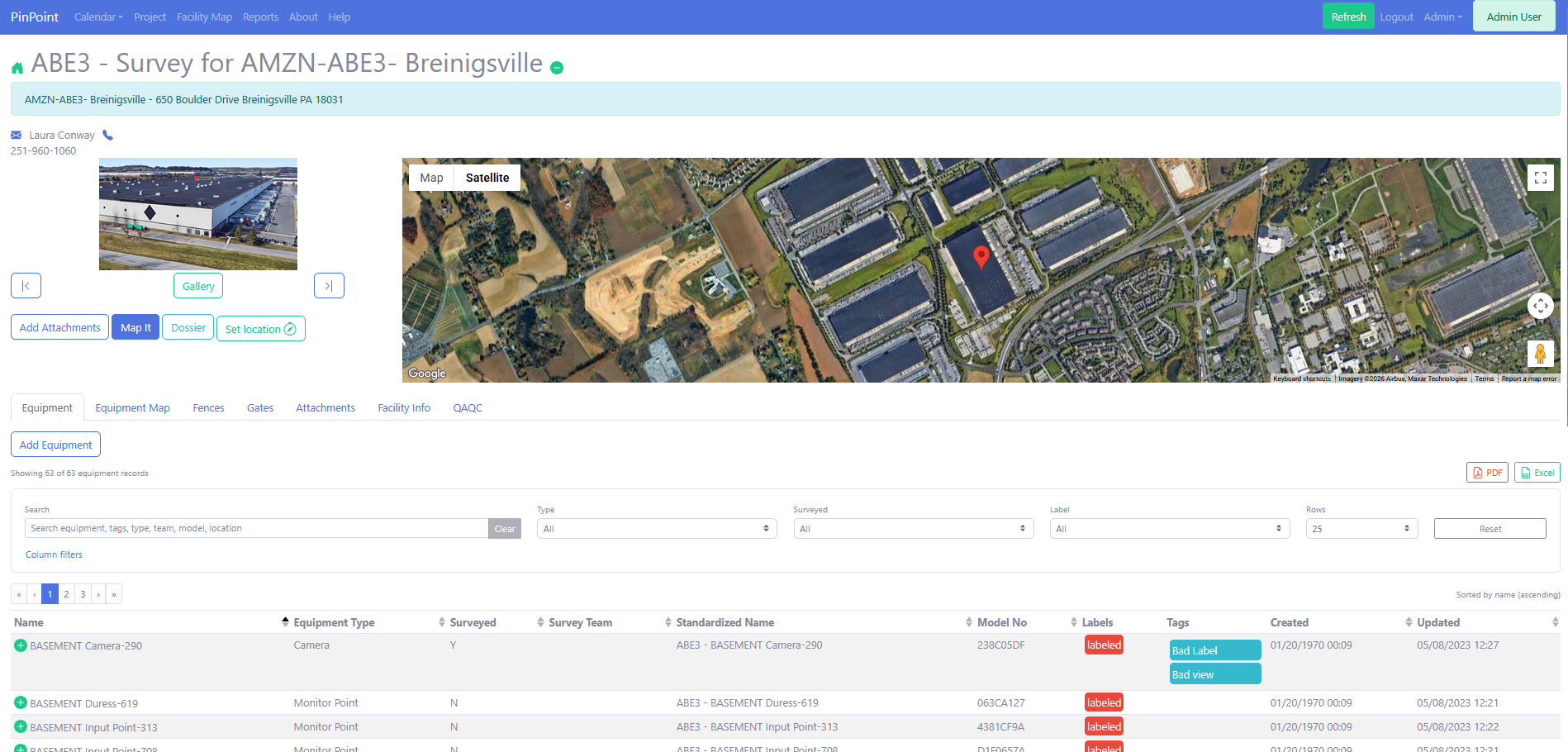
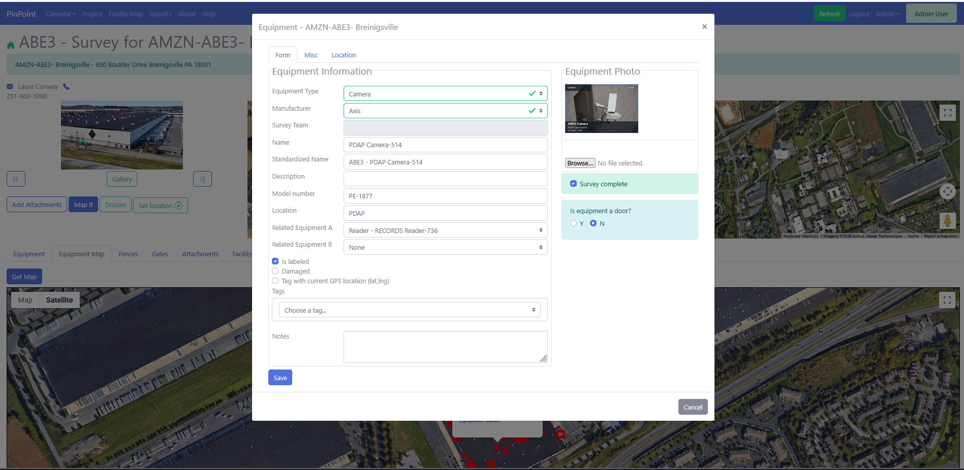
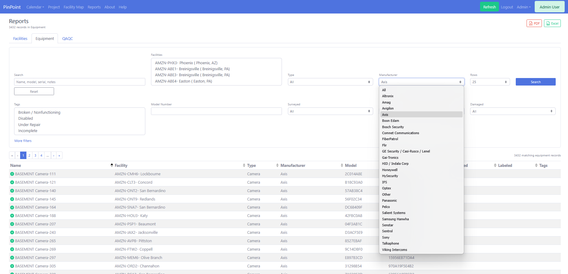
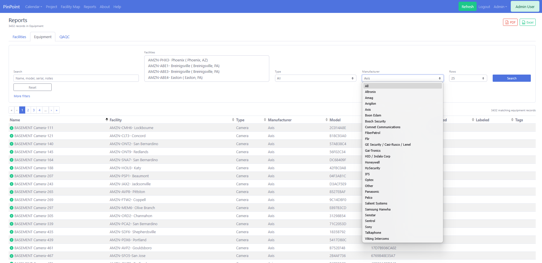
Capture equipment type, manufacturer, model, standardized names, surveyed state, labels, damage flags, tags, photos, and map positions.
Search, filter, sort, expand, and export facility, equipment, and QAQC results for field follow-up, client requests, and management review.
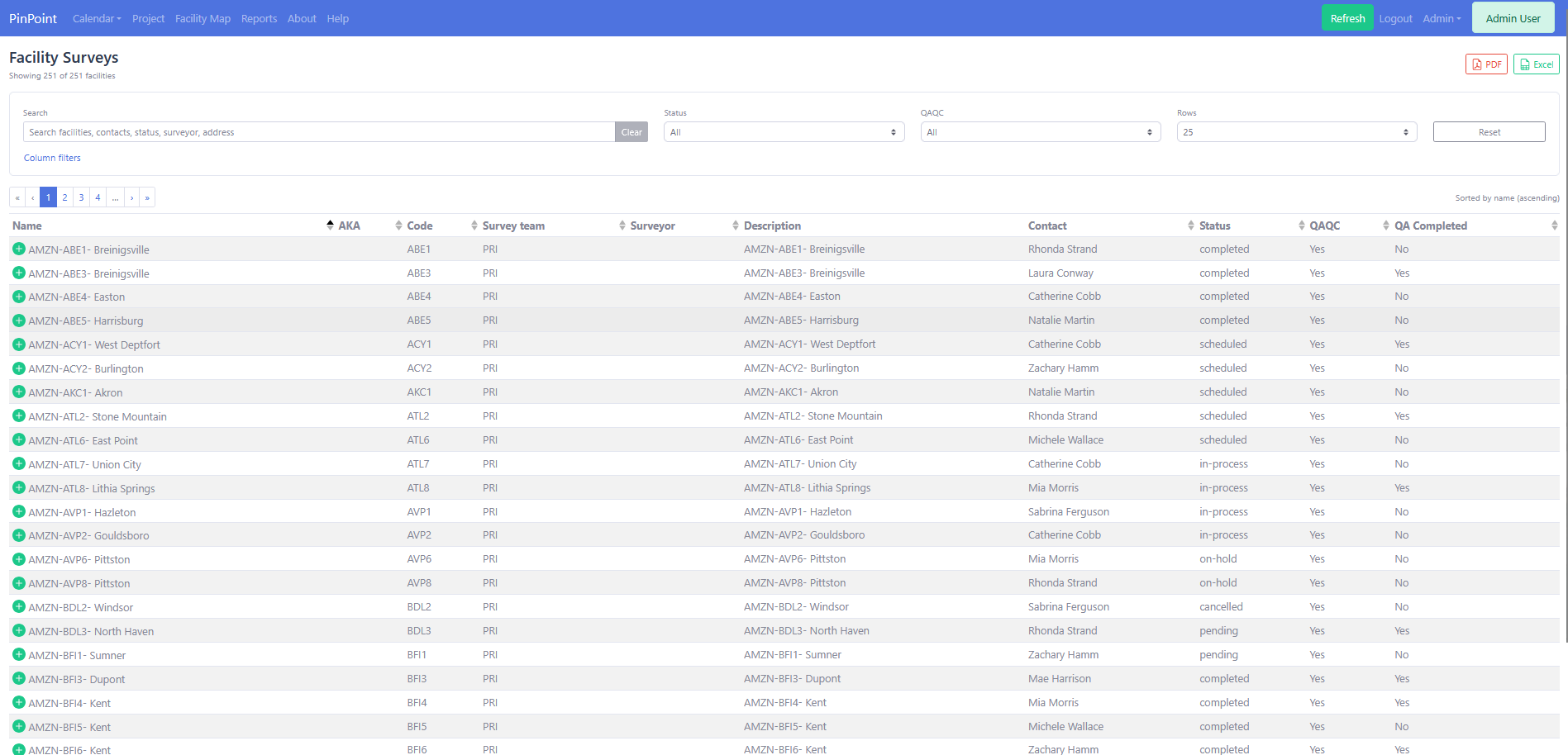
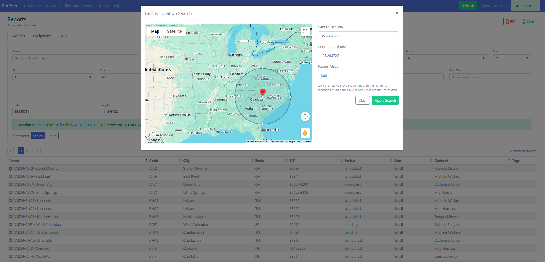
Facility teams can review every site in a searchable table, filter by status and QAQC state, expand rows for context, export results, and jump into the full survey record when deeper review is needed.
Each facility profile brings together contact details, survey photos, satellite imagery, equipment records, location tools, attachments, and dossier output. Field observations stay connected to the physical site instead of drifting into disconnected files.
The application is designed for repeatable survey capture, manager review, follow-up coordination, and deliverable production.
PinPoint gives each role a shared source of truth while preserving the details they need to do their part of the work.
Capture consistent site information, equipment details, photos, notes, tags, and map positions while reducing cleanup after the visit.
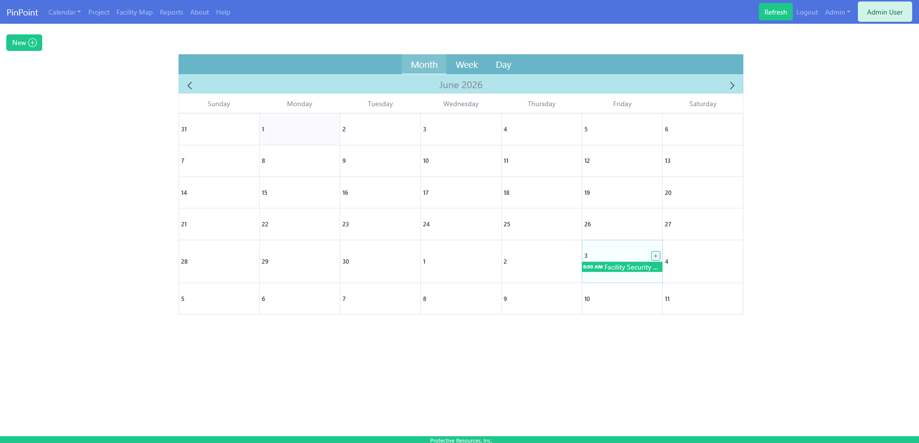
Review progress, track QAQC status, coordinate events, monitor coverage, and prepare polished reports for stakeholders.
Maintain visibility across many facilities, contacts, assets, deficiencies, open items, and follow-up priorities.
Manage users, pick lists, equipment types, tags, backups, database tools, activity reporting, and deployment health.
PinPoint is a mobile-friendly browser-based application designed for office use from a PC and field use from an LTE-capable tablet. The platform uses a Vue and TypeScript client, Kotlin and Spring Boot API, MyBatis persistence, Liquibase migrations, and production deployment assets for Docker, nginx, and Kubernetes.
PinPoint helps teams move from individual site records to a national or regional view. Facility maps, radius search, status coloring, and report filters make it easier to understand where work is happening and what needs attention next.
For Protective Resources, Inc. and its customers, PinPoint is a practical system of record for documenting sites, tracking equipment, managing QAQC, coordinating field activity, and producing professional outputs from structured data. Request a guided demo to review how PinPoint can support your facility survey workflow.
Tell Protective Resources, Inc. about your facility survey needs and request a PinPoint demo for field surveys, equipment documentation, QAQC tracking, reports, and facility intelligence.